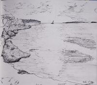
Sketchbook - Ouvéa
2009.07.16
I was sitting on some bluffs at sunset on the Island of Ouvéa and drew this picture. Later I drew the map at the bottom, looking at the ship’s charts, and added where we anchored and some of the towns and marked the major passages in the reef. Think I’ll make one of these for more of the islands we visit.
